Map Editor
NextBillion.ai Map Editor is a user interface application designed for creating and managing custom road permissions and restrictions. Its features enable the enforcement of access control, private turn restrictions, custom speed limits, and bespoke truck routing preferences.
How to access Map Editor?
In order to start using the Map Editor, you need to access the NextBillion.ai Cloud Console (NCC).
- Reach out to support@nextbillion.ai to get an account created for your organization.
- Sign-up on NCC using the contact email address provided above.
- Once you are on the NCC dashboard, click on the manila icon at the top left corner.
- Click on Apps > Map Editor.
Once inside the Map Editor app, reference the following sections to start editing and generating custom routes for your unique routing requirements.
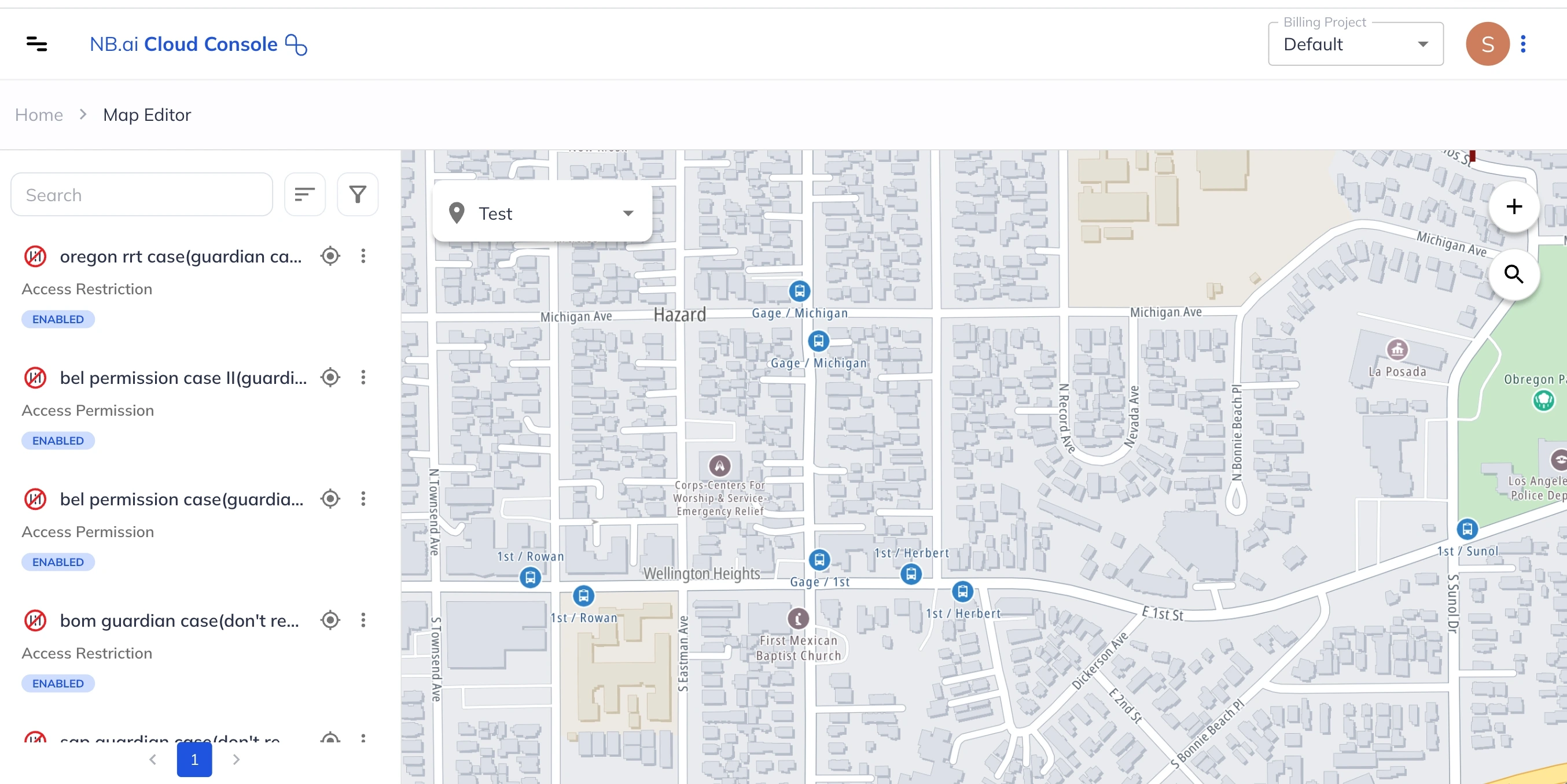
Map Editor Dashboard
See a quick demo below that highlights the main elements of the Map Editor Dashboard and their function:
Next, we will look at how to create each type of Map Edit.
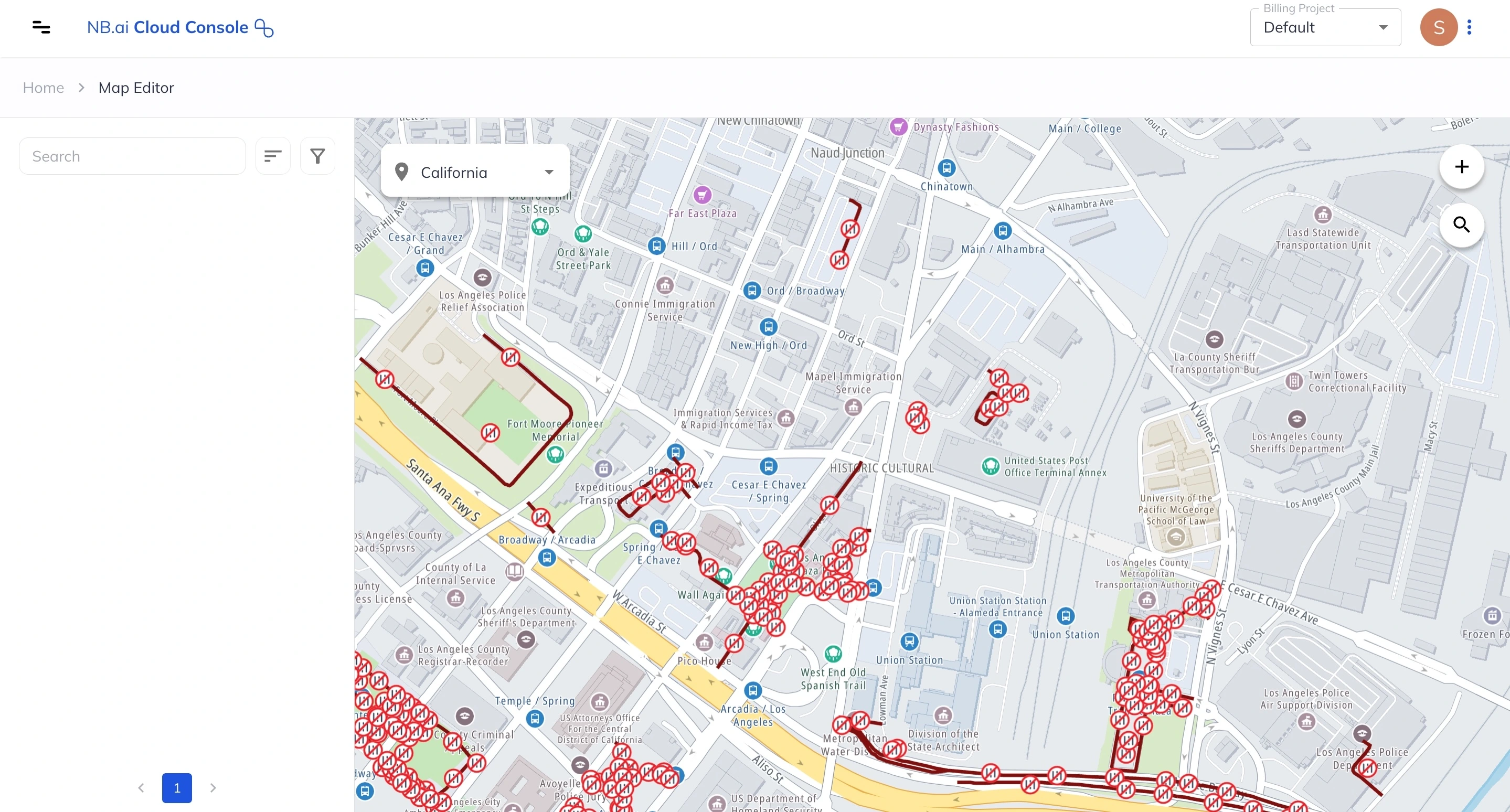
Create Edit Access Mode
Access Mode helps create and manage access restrictions or access permissions on desired road segments. Notably, certain roads, depicted in red by default, are inherently restricted based on the map source (e.g., within institutions, building complexes, residential communities). Conversely, other roads are available for general use, appearing as standard white road segments.
In Access Mode, users have the capability to adjust both road segment types to meet specific needs using the available modifications modes.
- Access Permission - Revert a default restriction from map data source
- Access Restriction - Restrict access on normal roads.
Here is an interactive demo for setting an Access Permission using Map Editor:
Create Edit Fixed Speed
Fixed Speed edits allow you to define specific travel speeds for various modes on selected road segments. Subsequently, the route engine utilizes these assigned speeds to compute custom Estimated Time of Arrivals (ETAs) whenever those particular road segments are incorporated into a route.
Following is a quick demonstration of how to add a fixed speed edit on given road segment:
Create Edit Max Speed Limit
Modifying maximum speed limits on road segments enables the setting of specific travel speeds for different transportation modes. This alteration allows the routing engine to calculate customized Estimated Time of Arrivals (ETAs) when these road segments are part of a route calculation.
Below is a demo that guides you through limiting the max speed using Map Editor:
Create Edit Turn Restriction
With turn restriction edits, you can specify disallowed turns on specific road segments. Consequently, when calculating routes, the engine will factor in these restrictions, recommending alternative routes that avoid the prohibited turns on those particular segments.
An interactive walkthrough for adding turn restriction via Map Editor follows:
Create Edit Truck Limit
Truck Limit restrictions enable users to define allowed truck dimensions—weight, length, height, and width—for specific road segments. This customization allows for routing fleet trucks along desired roads or alternative routes determined by road and truck types, as well as business needs.
Go through the interactive demo below to add truck limits for a road segment using Map Editor:
Please reach out to support@nextbillion.ai for any assistance required with your custom map edit requirements.